Structures in Waterways Field App
A free, purpose-built field data collection tool for identifying, assessing, and monitoring structures that may impact fish passage and waterway connectivity.
A CyberTracker Project
The Structures in Waterways Field App is a free tool developed by ATS Environmental using the CyberTracker platform. It streamlines the process of assessing structures in and around waterways — such as culverts, weirs, and bridges — and is specifically designed to support fish passage improvement projects.
Used by practitioners, councils, and community groups, the app allows users to collect consistent, structured data directly in the field, with built-in GPS logging and automated data storage.

What It Records
Each survey automatically captures:
-
Date and time
-
GPS location (latitude, longitude, altitude)
-
Device ID
And allows manual entry of:
-
Structure type and material
-
Dimensions
-
Fish passage features or barriers
-
Flow conditions and physical obstructions
-
Evidence of fish presence or use
-
Maintenance requirements
Survey Types & Status Codes
The app includes multiple survey types — Quick, Full, and Monitoring — to suit different project needs and site conditions. Quick Surveys are ideal for broad assessments or hard-to-access locations, Full Surveys provide detailed barrier information, and Monitoring Surveys help track change over time at previously assessed sites.
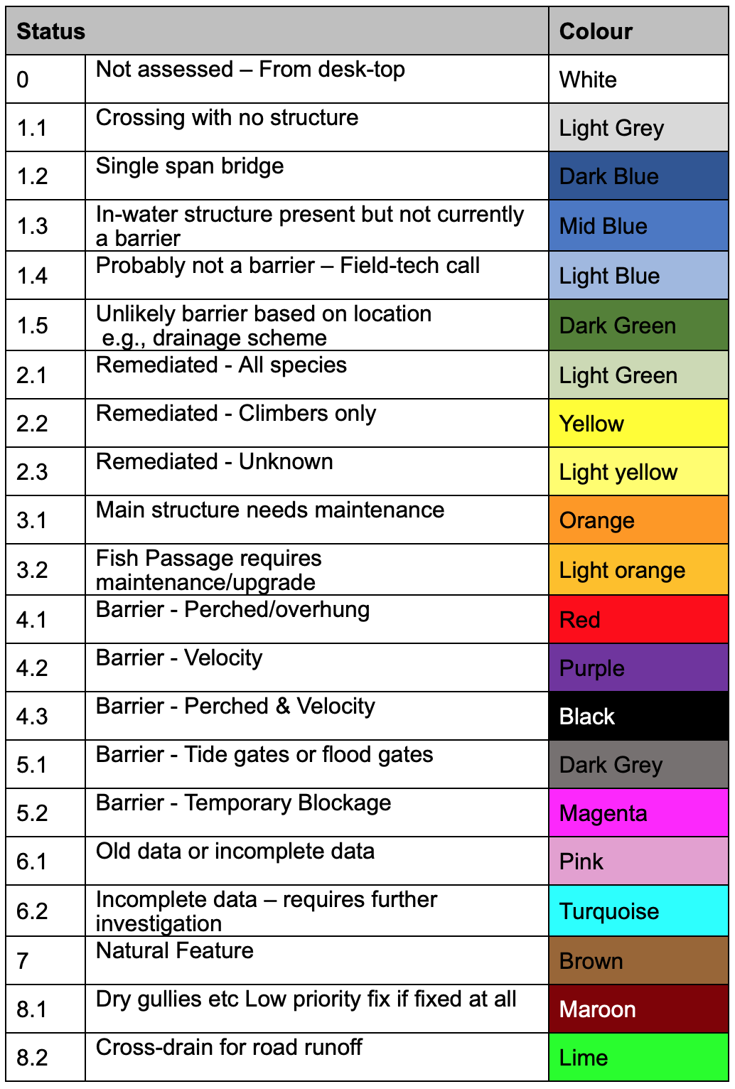
Each survey result is assigned a status code based on the structure’s characteristics, barrier impact, or data completeness. These codes are paired with a colour system to make it easy to visualise patterns and priorities — whether identifying confirmed barriers (like perched culverts or flood gates), remediated structures, maintenance needs, or natural features. This system allows teams to prioritise action, identify data gaps, and communicate findings clearly across projects or regions.

Why Use It
The Structures in Waterways Field App simplifies and streamlines the assessment of man-made structures in and around freshwater systems. By standardising how field data is collected, the app ensures consistency across surveyors, organisations, and regions. It’s designed to support everything from rapid field assessments to long-term monitoring and remediation planning, with built-in GPS, timestamping, and survey options that suit a wide range of users — from councils and consultants to community groups and researchers.
COPYRIGHT © – All rights reserved
Pat. 777607
